

Vision and Mission
E3SM will use exascale computing to carry out high-resolution Earth system modeling of natural, managed and man-made systems, to answer pressing problems for the DOE.
In 2013, the US Department of Energy developed a report summarizing observed long-term trends that, if continued for several decades, would have major impacts on the energy sector (DOE, 2013). Among these were regional trends in air and water temperatures, water availability, storms and heavy precipitation, coastal flooding and sea-level rise. The ability to simulate and predict significant, long-term changes in these environmental variables important to energy-sector decisions required capabilities beyond the existing state-of-the-science Earth system models running on the most powerful petascale computers at the time. Concurrently, DOE developed the Exascale Initiative, “a major computer and computational science initiative anchored in (DOE’s) mission challenges…. to capture the successful transition to the next era of computing in the 2020 timeframe,” while noting that “due to projected technology constraints, current approaches to HPC software and hardware design will not be sufficient to produce the required exascale capabilities.”.
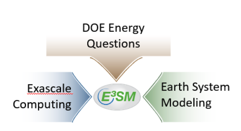
The Energy Exascale Earth System Modeling (E3SM) project, represented schematically in the image above, was conceived from this confluence of mission need and upcoming disruption of scientific computing technology. Developed as an ongoing, state-of-the-science Earth system modeling, simulation, and prediction project, it aims to optimize the use of DOE laboratory resources to meet the science needs of the nation and the mission needs of DOE for Earth system prediction. Laboratory resources include the people, programs, and facilities, current and future. They collectively represent a unique combination of scientific and engineering expertise as well as leadership computing and information technologies required to construct, maintain, and advance an Earth system modeling capability that is needed by DOE. The E3SM project’s long-term goal is to assert and maintain an international scientific leadership position in the development of Earth system models that address the grand challenge of actionable projections of Earth system variability and change, with an emphasis on the most critical scientific questions facing the nation and DOE.
Unique capabilities needed to address our grand challenge
Addressing our grand challenge requires a strategy of sustained advancement to overcome two major limitations:
- Pushing the high-resolution frontier of Earth system modeling. E3SM will remove the computational barriers to production-scale, high-resolution Earth system predictions through a combination of strategic model development and computational advances targeting exascale computers and beyond. Although other modeling centers have similar science objectives, E3SM uniquely integrates model development with leading-edge computational advances for a sustainable path toward ultra-high-resolution modeling with throughput for coupled Earth system simulations.
- Bridging the gap in scales and processes. The E3SM modeling system includes natural, managed and man-made systems for a new class of models that bridge the gaps in scales and processes represented by traditional Earth system models to address energy sector vulnerability to variability and change.
- Ensemble modeling to quantify uncertainty. Increasing model resolution and complexity is important for improving model fidelity, but Earth system predictions are challenged by large uncertainty associated with the system’s internal variability. To provide actionable predictions, E3SM will develop computational strategies for ensemble high-resolution simulations.
“to integrate the talent and assets from multiple National Laboratories (to construct) a DOE- Earth System Model (ESM) … at ultra-high resolution (eddy-resolving in the ocean and at the hydrostatic limit in the atmosphere), and able to run efficiently on DOE Leadership Class Facility computers.”
— DOE charge
Integrating the talent and assets from multiple National Laboratories
Our charge in 2014 was, “to integrate the talent and assets from multiple National Laboratories (to construct) a DOE- Earth System Model (ESM) … at ultra-high resolution (eddy-resolving in the ocean and at the hydrostatic limit in the atmosphere), and able to run efficiently on DOE Leadership Class Facility computers.” The high-resolution version of E3SM v1 satisfies this charge by coupling an atmospheric GCM based on the highly-scalable spectral element dynamical core at 25km grid spacing with new ocean and sea-ice models at 6-18km grid spacing capable of explicitly simulating sea-level rise and the most energetic motions in the ocean.
Building on this past progress, the E3SM project will address the next challenge of (1) enabling ensemble coupled simulations using the high resolution model to address science questions, and (2) developing the science and computational capabilities for ultra-high resolution simulations that explicitly resolve deep atmospheric convection in multi-decadal fully-coupled Earth system model experiments. The latter defines our target of grand challenge simulations for E3SM to be accomplished by 2027.