

v1 High-Res 1950-Control
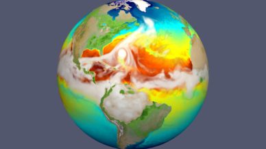
The high-resolution E3SM earth system model simulates the strongest storms with surface winds exceeding 150 mph—hurricanes that leave cold wakes that are 2 to 4 degrees Celsius cooler than their surroundings. This simulation from E3SM represents how sea surface temperature changes evolve as a hurricane (seen here approaching the U.S. East Coast) moves across the Atlantic and how the resultant cold wake affects subsequent intensification of the next hurricane.
This coupled 1950 control simulation is our first high-resolution simulation of the water cycle v1 campaign with the E3SM v1 high-resolution model. In this simulation, land and atmosphere use horizontal grid spacing of ~25 km, while ocean and sea-ice components use 8 to 16 km grid spacing. As in all E3SM water cycle simulations, CO2 (and other GHGs) concentrations is imposed.
This simulation was configured to adhere as closely as possible to the HighResMIP protocol for a coupled control run as outlined in Haarsma et al. 2016, GMD. As described in that paper, the 1950 control run is meant to act as a pre-industrial control simulation while avoiding the need to simulate the period between 1850 and 1950 when using this simulation as the starting point for a 20th century historical simulation. Starting in 1950 instead of 1850 is needed because high-resolution models are too expensive to run for that extra 100 years, but is also a compromise because the planet was not actually in equilibrium at 1950 and 1950 is only a crude proxy for pre-industrial conditions.
The E3SM 1950 control run differs from the HighResMIP protocol in that HighResMIP specifies atmospheric aerosol concentrations while E3SM prognoses them using anthropogenic and fire emissions taken directly from the CMIP6 protocol. One exception is SOA gas precursor emissions, which were modified to emit from elevated surfaces as well. Ocean/ice initialization was also different from HighResMIP. First, the E3SM ocean state was initialized from a blended observations project (World Ocean Circulation Experiment and Polar Hydrographic Climatology). The ocean was then run by itself for 30 days to allow gravity wave propagation (thereby allowing the next stage of simulation to run with a larger timestep). The resulting ocean state is then used to initialize a 3-year simulation with atmosphere and land forcing prescribed by observations from the COREv2 dataset (Large and Yeager, 2009, Clim. Dyn.) and sea ice initially distributed as hemispheric caps of constant thickness. The result of this latter simulation was used to start the E3SM 1950 control run. Tuning for this simulation was performed in runs with prescribed-SST and sea-ice extent.
The Simulations
The high-res simulation campaign is based on the E3SM code version v1.0. Its flagship calculation is a 50-year-long high-resolution simulation with time-invariant 1950 forcings following the HighResMIP CMIP6 protocol (“1950-Control”).
To assess model sensitivity to anthropogenic GHG and aerosol changes, short simulations with prescribed sea surface temperature and sea ice extent were also performed. For historical reasons, such simulations are referred to as “F” cases. To isolate the effect of resolution, each of these runs (“1950-Control” and all “F” runs) were repeated at standard resolution. For F cases, these standard-resolution simulations were performed using both the parameter settings for the high-resolution model and separately with the parameter values from the standard-resolution release. Standard- and high-resolution configurations have different parameter settings to compensate for the effect of resolution change on model behavior. For details, see the high-resolution overview paper by see Caldwell at al., 2019.
Get data from these simulations