

New Hexagonal Mesh Watershed Delineation Model
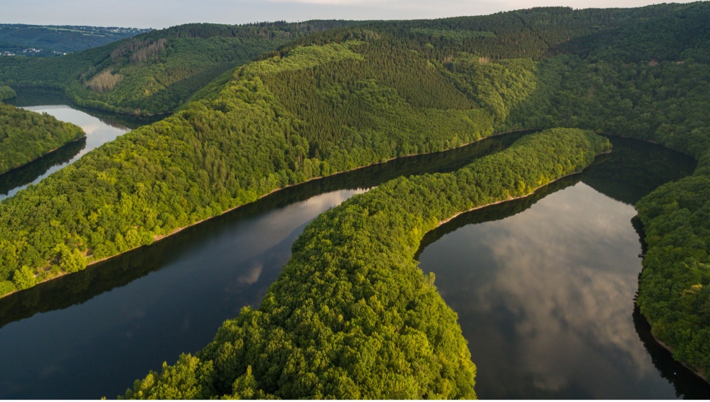
Figure 1. An example of complex river terrain, image by Eifel Tourismus GmbH | Flickr
The ICoM-ESMD team developed a new hexagonal mesh watershed delineation model, which will enable researchers to run fully coupled land-river-ocean simulations using a unified mesh framework to further understand the coastal dynamics under a changing earth system.
The Science
To model rivers, researchers use simplified, conceptual river networks to represent real-world river networks. This is difficult, as real-world river networks are very complex (Fig. 1). In addition, any practically useful conceptual river networks need to be compatible with the different types of meshes employed by hydrologic and Earth system models. A recent study (Liao, et al. 2020) showed that hexagon-based watershed discretization has several advantages compared to the traditional Cartesian (latitude–longitude) discretization, such as uniform connectivity and compatibility with other Earth system model components based on unstructured mesh systems (e.g., oceanic models). Despite these advantages, hexagon-based discretization has not been widely adopted by the current generation of hydrologic models. One major reason is that there is no existing model that can delineate hexagon-based watersheds while maintaining accurate representations of flow direction across various spatial resolutions.
The Impact
To better understand the water cycle in complex landscapes, researchers need to represent different hydrologic features (e.g., river, lake, and ocean) in a way that allows them to freely interact. Developing the capability of representing real-world river networks in an unstructured mesh brings models one step closer to allowing rivers and other hydrologic features to consistently interact. This research also helps improve coastal zone Earth system modeling, which is critical for understanding the effects of a changing earth system.
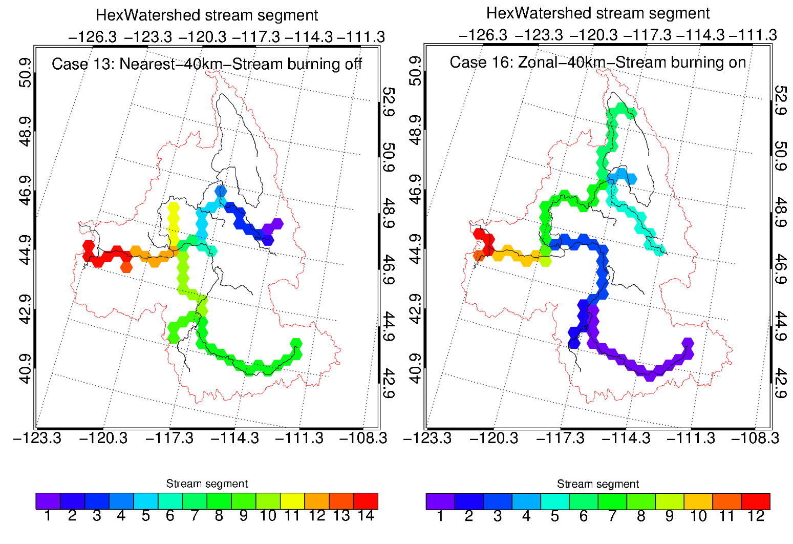
Figure 2. With the stream burning feature turned on (right), the HexWatershed model significantly improves the river network representation compared with when it is off (left).
Summary
Better modeling the complex interactions between different hydrologic features in the Earth system requires representing these features in a flexible way. This often requires a better representation of their locations and geometries.
The HexWatershed model is the world’s first and only watershed delineation model based on the hexagonal mesh, designed to move away from the traditional rectangle grid toward a fully unstructured mesh framework. An unstructured mesh framework provides a more realistic approach for capturing hydrologic features. Based on the HexWatershed model, researchers developed new capabilities to conduct “stream burning,” a technique often used in watershed hydrology, on real-world river networks. This converts them into meshes that can be consistently represented in any mesh system at any spatial resolution.
Researchers applied these improvements to the Columbia River basin and performed 16 simulations with different configurations (Fig. 2). The results show that (1) spatial resampling modulates flow direction around headwaters and provides an opportunity to extract subgrid information; and (2) stream burning corrects the flow directions in mountainous areas with complex terrain features.
This study paves the way for fully couped land-river-ocean Earth system model simulations under a unified mesh framework.
Publication
Liao, C., Tesfa, T., Duan, Z., & Leung, L. R. (2020). Watershed delineation on a hexagonal mesh grid. Environmental Modelling & Software, 128, 104702. [DOI: 10.1016/j.envsoft.2020.104702]
Liao, C., Zhou, T., Xu, D., Barnes, R., Bisht, G., Li, H.-Y., Tan, Z., Tesfa, T., Duan, Z., & Engwirda, D. (2022). Advances in hexagon mesh-based flow direction modeling, Advances in Water Resources, 104099, (2022). [DOI: 10.1016/j.advwatres.2021.104099]
Funding
- This work was supported by the Earth System Model Development program areas of the Department of Energy, Office of Science, Biological and Environmental Research program as part of the multi-program, collaborative Integrated Coastal Modeling project.
Contact
- Elizabeth Hunke, Los Alamos National Laboratory
- Chang Liao, Pacific Northwest National Laboratory
This article is a part of the E3SM “Floating Points” Newsletter, to read the full Newsletter check: