

Hurricane Sandy Simulation
Using E3SM version 1, hurricane hindcasts at 1/8 degrees based on the Cloud-Associated Parameterizations Testbed (CAPT) are used to show the capability of realistically simulating extreme weathers and explore further development of convective and cloud microphysical parameterizations at high resolution. Such practices are also expected to be helpful to assess the tuning need.
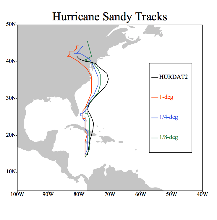
As expected, the 1/8-degree model gives the most realistic hindcast of the 2012 Hurricane Sandy, compared to 1-degree or 1/4-degree models. This includes the strength of the storm (as defined by storm center sea-level pressure), the track, and the evolution of cloud structure (including a well defined eye wall). Please note that the storm is under-developed when using the 1-degree model, but over-developed with both 1/4- and 1/8-degree models, as can be seen from the sea-level pressure movies, in comparison with the GFS analysis. At least for this case, the more developed system (as with the 1/8-degree model) also comes with better predictive skill for the track of the hurricane.
How the deep convective parameterization is used for the 1/8-degree model can have very noticeable effect on tropical convective systems (for example, over the Intertropical Convergence Zone, or ITCZ, and Amazon), as can be seen from both simulated IR movies and precipitation images (in comparison with TRMM). The reality, judging from precipitation images, seems to lie in between the two. Over developments of isolated convective precipitation systems, when the role of deep convective scheme is diminished, are presumably due to deficiency in cloud microphysics, especially ice cloud microphysics, which is also a common issue for even cloud-resolving model simulations.
Evolution of the hindcast of Hurricane Sandy is initialized at 00Z 10/24/2012, about 1 week before hitting coastal NJ/NY.
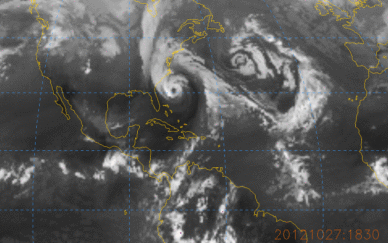
A video of E3Sm v1 1/8 degree model hindcast of hurricane Sandy.
Credit: Wuyin Lin, Brookhaven National Laboratory